How the Department for Transport used HSE's National Population Database to inform transport investment


The Challenge
The UK Department for Transport (DfT) needed the latest and most
accurate data available on residents, workers and other populations
in any location, down to individual building level. The data needed
to be of high quality so that it could be trusted by government to
inform all transport investment in England. The dataset would have
to have unmatched levels of granularity to feed in to DfT's own
data modelling that is used for policy forecasting and the
strategic testing of roads.
The Solution
The HSE National Population Database (NPD)
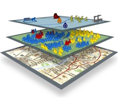
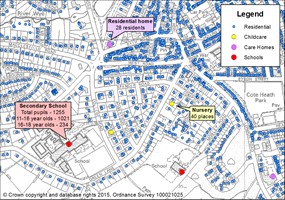
is a unique Geographical Information System (GIS) dataset that
enables populations of various types to be estimated in any
location in Great Britain and at different times of the day, down
to individual building level. Developed by HSE, the dataset
combines HSE's own data with Ordnance Survey and Royal Mail
information and presents it on a map using a purpose-built
portal.
For over 40 years as Great Britain's health
and safety regulator, the Health and Safety Executive (HSE) has
used robust analysis techniques to extract intelligence from the
data we collect. We use it to inform and prioritise regulatory
activity, underpin guidance and policy, and support scientific
research activities. This means we're uniquely and ideally placed
to bring together powerful datasets from across Government to build
a useful, trustworthy and unique tool like the NPD.
By intelligently estimating the population of any GB location at
any time of day or night, the NPD can help to minimise risks to
your employees, assets and the general public. For example, the NPD
can be used to minimise the risk associated with major building
works by construction or utilities companies; to enable telecoms
providers to optimally position mobile communications masts; to
provide transport companies with traffic management modelling
capabilities; to give businesses confidence in emergency resilience
or disaster recovery planning.
The NPD's dataset is so trusted and reliable that it is used by
the UK government's Resilience Direct platform. This
secure online network for sharing real time information enables
emergency services to deliver an efficient and co-ordinated
response in situations that impact civil protection.
The Outcome
DfT considers the NPD to be the best
population mapping data available. Without it they would be forced
to use inferior data, providing outdated information. This would
directly impact the effectiveness of their models and, therefore,
the UK transportation networks.
See for yourself!
The NPD
portal lets you experiment with a demonstration dataset
and discover how you and your work could
benefit.
Contact us for more information: npd@hse.gov.uk
Watch our video introduction of the tool
below. Can't see the video?
View it here
Back to the top