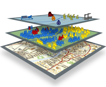
The yearly 'International Geographical Information
Systems (GIS) Day' was celebrated on 15 November in 2023.
The day was set up to celebrate and recognise achievements by
geospatial specialists around the globe and to highlight the
benefits that GIS bring.
Most people are familiar with Google Maps and having the power
of geography in the palm of their hand: to find your way, the
whereabouts of a specific shop or even the location of other family
members! The GIS used by such applications
also play a crucial role within HSE to support evidence-based
decision making and help us achieve our strategic objectives.
Development of the National Population
Database
The National Population Database (NPD) supports
HSE's geographical risk assessment work and work for other
organisations in Government and externally. The NPD is a trusted
and versatile resource for geo-demographic analysis in GB and has
been used to support the assessment of potential nuclear sites by
the Office for Nuclear Regulation (ONR), estimate flooding risk in
Met Office forecasting models, and for understanding demand for
transport planning models by the Department of Transport. The team
have recently won funding from the Government Office for Technology
Transfer (GOTT) to improve the database and make it more accessible
outside of HSE.
Management and maintenance of the geospatial
data
Management and maintenance of the geospatial data is crucial to
HSE's Land Use Planning system. Access to
geographical data and maps showing the locations of major accident
hazard pipelines, major hazard sites and explosive license
locations allows evidence-based decisions to be made, supporting
our role as a statutory consultee for planning applications around
such locations. HSE's Geospatial team have recently developed a new
browser-based mapper tool for CEMHD5 that will significantly
improve the way that the Land Use Planning data can be
interrogated.
Provision of geospatial data including Ordnance Survey
Address and background mapping data
Use of government mapping data and official addressing standards
such as Unique Property Reference Numbers (UPRNs) helps to ensure
the quality of our data and aid collaboration and further analysis.
Maps generated by the Geospatial Team provide vital evidence to
support prosecutions and inform planning decisions.
Analysis work as part of the COVID-19 National Core
Study on Transmission and Environment
Analysis by the Geospatial Team has helped in the understanding
of outbreaks in workplaces through collaborations with the UK
Health Security Agency, University of Manchester and the Office of
National Statistics. Modelling work combined data on risk factors
such as socio-demography, environment, industry and travel to
estimate the risk of outbreaks at workplaces. As part of the
Wear-It project, analysis of data collected from wearable devices
captured the broad location of workers and their proximity in
different types of workplaces allowing scientists to gain valuable insight on
personal interactions at work. This is important for
understanding the risks of transmission and spread of transmissible
respiratory diseases in workplaces, and for planning effective
targeted mitigation tactics.
Find out more
If you would like to know more about what HSE's Geospatial Team
do, and how you can work with this cross-cutting team of analysts,
data specialists and geographers, please get in touch via: geospatial@hse.gov.uk
For more information on GIS Day there are posters and activities
(suitable for all ages) available on the GIS Day website: https://www.gisday.com/en-us/resources